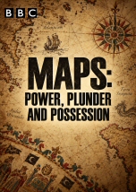
Professor Jerry Brotton reveals that maps are far more than neutral guides to places: they are expressions of the societies that create them and powerful instruments for shaping territory, belief and authority. Beginning with some of the earliest known maps, he traces how cartography evolved from marking land and ownership to serving kings, empires, scientists and governments. From Henry VIII’s coastal surveys and the Cassini family’s scientific breakthroughs to the drawing of modern national borders, the series shows how maps can define who controls land, who belongs where and even how entire peoples understand the world around them. Across the three episodes, presented here together in a single uninterrupted video, the journey moves from ancient and medieval worldviews to imperial expansion and the digital age. Brotton explores religious maps, Aztec symbolism, Victorian attempts to classify societies, the politics behind projections of the globe, and the rise of Google Earth and data-driven mapping. He then follows the mapmakers and explorers who turned distant lands into targets for conquest and profit, from Ptolemy and Columbus to Walter Raleigh and the trading empires that followed. The story ends in the Arctic, where new maps are once again being used to stake claims over oil, gas and minerals, proving that even in the twenty-first century, cartography remains inseparable from power, plunder and possession.









Across the three episodes, presented here together in a single uninterrupted video, the journey moves from ancient and medieval worldviews to imperial expansion and the digital age. Brotton explores religious maps, Aztec symbolism, Victorian attempts to classify societies, the politics behind projections of the globe, and the rise of Google Earth and data-driven mapping. He then follows the mapmakers and explorers who turned distant lands into targets for conquest and profit, from Ptolemy and Columbus to Walter Raleigh and the trading empires that followed. The story ends in the Arctic, where new maps are once again being used to stake claims over oil, gas and minerals, proving that even in the twenty-first century, cartography remains inseparable from power, plunder and possession.